Able to Quickly Deploy and Loiter Over a Disaster Area for Hours and Days, Drones Provide an Essential Emergency Response Capability and Support for First Responders.
Unmanned aerial systems (UAS) operating in emergency response utilize the same sensors as military drones to quickly scan the terrain, track movements, and changes, and deliver 3D terrain mapping. On civilian missions, drones can also measure various indicators, like water level, temperature, and wind, and assess fire dynamics, water flow, and pollution. By evaluating the condition of roads, highways, bridges, airports, ferry terminals, waterways, and dams across the impacted area, drone technology ultimately enables first responders to make informed decisions about how to act.
These capabilities can be delivered by small drones, on relatively short missions, or by a few large drones. These drones cover large areas and require fewer operational resources. These drones, classified as ‘medium-altitude long-endurance – (MALE) UAS, are particularly suitable for deployment in complex environments. They can operate continuously over jungles, flooded plains, and mountainous and remote areas, where access is limited and resources are scarce. Such drones can cover huge areas with continuous surveillance, providing a watchful eye, assisting first responders on the ground, and providing real-time information for planners and directors at disaster management centers.
Supporting the Firefighters
Wildfires have become a common hazard fought by firefighters on the ground and manned aircraft flying at extremely low altitudes. Drones have become an essential asset in assisting firefighting. Their thermal imaging penetrates thick smoke to spot active fires, even where such fires are too small or invisible to the human eye. Situational analysis and propagation reports are relayed in real-time, providing firefighters on the ground with time to respond.
Lifesaving Rapid Response
In response to earthquakes and tsunamis, drones offer the unique capability to quickly scan a large area and assess the situation, enabling first responders to react to the most needed areas. High-resolution imaging and 3D mapping payloads become highly desired in these situations, as they repeatedly cover the area and employ change detection processing to assess the effects of aftershocks, locating collapsed buildings and survivors.
A Tsunami is another type of disaster that authorities can prepare for using remote sensing to obtain actionable information. Unlike an earthquake that happens instantly, early warning enables seismologists to warn the population of expected Tsunami hours before it happens. Using a drone’s altimeter to monitor the ocean surface far from shore can spot and assess the tsunami wave as it travels and help predict its direction.
Persistent Surveillance and Security
Intelligence, surveillance, and reconnaissance (ISR) techniques are often employed in emergencies. On such missions, drones may carry WAMI equipment that can indicate anomalies in human behavior within the affected area. Hyper- and multi-spectral imagers can monitor water reservoirs, detecting and warning of flooding, contamination, or leaks of hazardous materials. These sensors can also report leaks from infrastructures and pipelines in real time and identify potential damage to chemical plants, sewage leaks, or risk of overflow at remote water reservoirs.
Quick Recovery
Using communications pods on military or government-operated drones, authorities can scramble to recover cellular communications that are often damaged in a disaster area. Cellular cells established by drones provide an emergency information cloud assisting rescue forces without dependence on terrestrial communications towers.
Quick Response
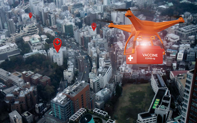
Drones provide critical advantages in emergencies in rural or urban areas, quickly responding to emergencies from terror attacks to enforcing movement limitations and curfews in response to epidemic contagion. Small multirotor drones deliver an elevated view to enhance situational understanding in these situations. Providing every police patrol’s quick response, small drones can be deployed by every police car, responding to any city emergency. These drones can feed live video to the patrol car and relay communications to the central dispatch. Quick reaction is essential in emergencies like mass casualty incidents or marine disasters when every second counts to saving lives. In addition to small drones operating with patrol cars, larger ones can be dispatched by helicopters, ambulances, and the fire brigade to assess the situation. Drones would be most efficient at medium altitudes since extensive air activity is expected at the scene.
The US Federal Aviation Agency (FAA) has permitted operators to fly drones beyond the visual line of sight (BVLOS). This approval is crucial for emergency and disaster response because it allows drone operators to access hard-to-reach areas within minutes instead of hours.
With the UAS increasing role in the military, homeland security, and commerce, drones also prove critical for disaster relief and emergency response. Whether military drones operating payloads and sensors designed for ISR missions, federal assets using specialized sensors developed for emergency response or commercial drones leased on demand, UAS has become a critical element in the national emergency response toolbox.